
 English
 Follow us








![[Tancar]](/plantilles/bergueda/img/tancar.png)

Landscapes near Castellar
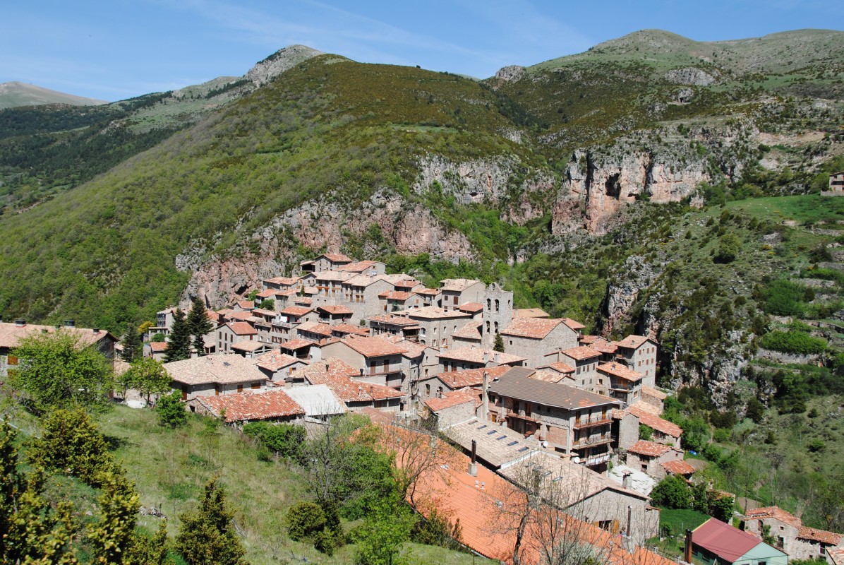
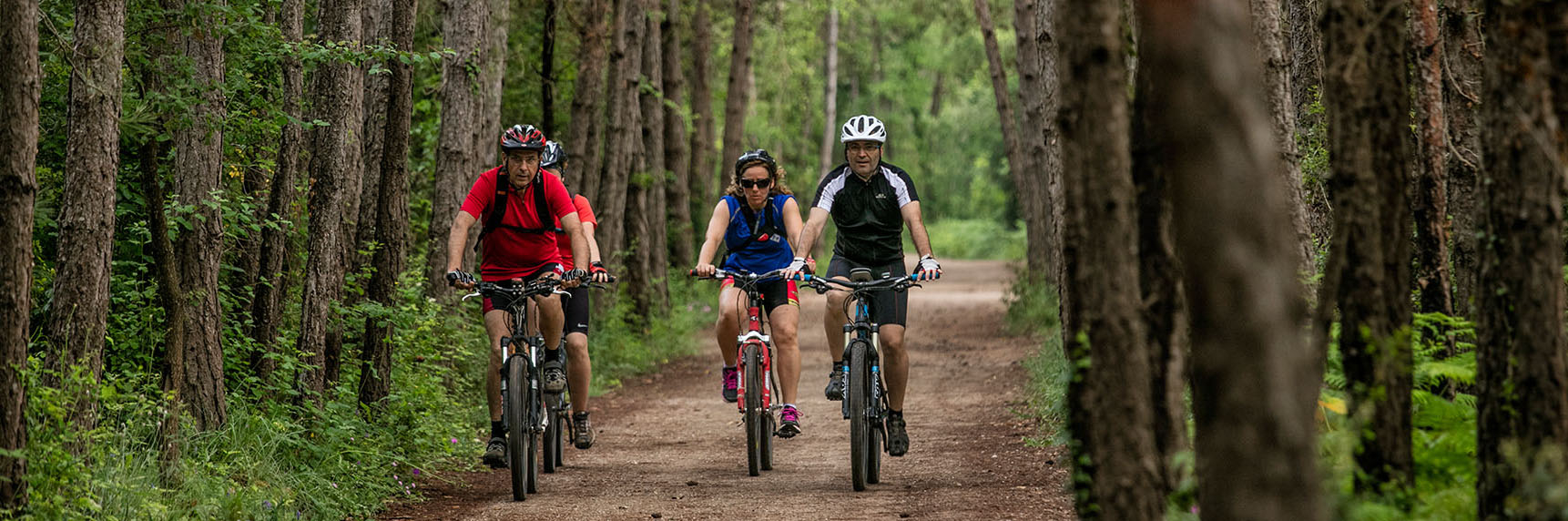
The natural surroundings located north of La Pobla de Lillet often offer breathtaking landscapes. Cycling around Castellar de n’Hug, a new surprise appears at every corner and every bend in the trail. The meadows, pastures and variety of forests are always extraordinarily beautiful. With a minimum elevation of around 1,000 metres and a maximum above 1,900 metres, the route runs at an average altitude of around 1,500 metres. Unfortunately, some paths are closed to public access as they are exclusively for private use, while many others have disappeared in a territory that, over recent decades, has gradually stopped relying on mountain activities —with a few exceptions— and has come to depend almost exclusively on tourism. Completing a route around the entire area —which, due to its rugged terrain, already has relatively few paths— is practically impossible without covering kilometres and kilometres of asphalt. Even so, it is still possible to follow a route taking in the area's main highlights, with almost 50% of the route running along mountain tracks. Beautiful trails in a truly privileged setting.
Description
The route starts at Clot del Moro, a very unique place. It was once the starting point of the Asland cement factory and, for this reason, the point where the narrow-gauge railway terminated. The route passes between the different sites (Transport Museum and Factory Museum) before leaving the asphalt at a sharp 360º left-hand bend, following the track that climbs towards Erols Refuge along the GR-4. The track climbs comfortably through beautiful surroundings, turning right and passing above the refuge towards Coll Roig (located in an area characterised by reddish soil). However, before reaching it (less than one kilometre after Erols), leave the track leading there —and also the GR— and turn right towards Rus and Collet de Casa Nova.
Half a kilometre further on, leave a track climbing to the right and soon reach Collet de la Casa Nova. Continue straight ahead along the track that descends directly, leaving aside the paths to the right and left that either come to an end or have become partially overgrown. The route descends through a beautiful woodland, first among holm oaks and then through a small, wonderful beech grove, until reaching the road.
Turn left and the route soon crosses the small Monell bridge. 250 metres further on, leave the road and turn towards Sant Vicenç del Rus. Built on top of an earlier pre-Romanesque chapel, the magnificent Romanesque church contains wonderful paintings inside —faithful copies of the originals— which are well worth a visit. Like Sant Llorenç Prop Baga, upon which it depended, it was also affected by the earthquakes of 1420 and 1430, which damaged the walls of the building.
The route goes around the neighbouring building (La Farga Nova) and descends towards the river along a rather rough track. On the other side of the river, leave the path that soon turns right in a 360º bend (followed by another dead-end section a few metres further on), and continue along the main track, which climbs steeply through fairly clayey and slippery terrain. In barely half a kilometre, the route climbs 750 metres... The route leaves aside two tracks climbing to the right along the first flatter section, just after crossing the river, where the surroundings are extraordinary and the views are magnificent. Half a kilometre further on, leave a track entering on the left (a dead end that disappears before reaching the road) and, around 300 metres later, another one on the right, both starting beside the stream. Another 700 metres further on, leave a track climbing to the right (which ends in a dead end at the bottom of the valley, after passing the Pla de Puiners) and continue along the main track, which becomes increasingly wider, easier to ride and soon starts to level out. It eventually descends onto the asphalt at Collada de Cal Ros, before climbing again towards Castellar de n’Hug. At the BV-4031 road, cross it and continue along a track climbing on the other side. At the small crest, follow the paved track climbing to the right towards the football pitch. At this point, if you want to take a break, you can reach the centre of Castellar de n’Hug, where you will find services, by going down the street on the left.
After the football pitch, the route soon joins the road again, which climbs gently. Approximately one kilometre later, after passing the turn-off for Sant Joan de Cornudell and just before kilometre 14, follow a track on the right. For around 6.5 km, stay on the main track, always following the route that climbs (leaving those descending aside) and always keeping to the left (also leaving those turning right aside), through wonderful scenery. Among black pine forests, extensive open areas, grazing livestock and small valleys... a delight for the surroundings and a joy for the senses! After passing a small pleta (an area used for livestock, generally with a small enclosure) on the right, the route levels out and even descends slightly.
Back on the road, the route climbs the final 3.5 km to Coll de la Creueta, where the views over the Berguedà are truly spectacular.
The return journey follows the road all the way to the turn-off for Clot del Moro, signposted as the Cement Museum and Cement Train, where the route began, with two exceptions:
The first is when reaching Castellar de n’Hug. Just after kilometre 13, the route climbs again towards the football pitch and then exits through the village, cutting out a short section of road.
The second is to access the Llobregat Springs. Around 500 metres beyond kilometre 9, the route turns right at a junction signposted “Fonts del Llobregat”. The paved track first, and then the dirt track, climbs gently to the Llobregat Springs. To reach the springs themselves, the final few metres must be walked; the path is narrow and there are often many visitors. Even if you have a lock, you can leave your bicycle secured at the car park of the Molí de les Fonts Restaurant. The Llobregat Springs are one of the most visited places in the Berguedà and are truly worth seeing. After recent rainfall, they become a fantastic spectacle of cascading waterfalls. Once you have visited them, return down the same track, but instead of taking the paved path on the left, continue along the wide track, passing beside Hostal les Fonts. A beautiful stone bridge can be found just behind it.
The route ends at Clot del Moro, where it began.
Technical sheet
Route number: 41
Town: Castellar de n'Hug
Type: Difficult
Starting point: Clot del Moro, road from La Pobla de Lillet to Castellar de n'Hug
Ending point: Clot del Moro, road from La Pobla de Lillet to Castellar de n'Hug
Distance: 45,31 km.
Time: 5 h.
maximum altitude: 1.923 m.
height difference: 1.480 m.
Signals: Unmarked route
To organise
Cartography: El Berguedà. Mapa Comarcal de Catalunya. 1:50.000. Institut Cartogràfic i Geològic de Catalunya.
More information
Bibliography: Descobrim el Berguedà. Consell Comarcal del Berguedà i Patronat. Comarcal de Turisme. (1991). Guia turística. Castellar de n’Hug. Cabani, J. (1985). La llar del llibre. Castellar de n'Hug i la seva rodalia. Lorente Segura, J. Tot Editorial. El Berguedà. Pladevall, Antoni. Editorial Pòrtic (2001). ISBN 9788473066976.
Documents and links
[TambeInteressar]
- >

OFICINA DE TURISME DEL BERGUEDÀ
Customer service opening hours:
from Monday to Friday from 9 am to 2 pm.
on public holidays falling from Monday to Friday from 10 am to 2 pm.
Tel. +34 654 125 696
E-mail: turisme@elbergueda.cat

ACKNOWLEDGMENTS


[Premsa]
Other






Follow us


