
 English
- Català
- Español
- Français
 Follow us








English
- Català
- Español
- Français

SEARCH
Follow us
![[Tancar]](/plantilles/bergueda/img/tancar.png)

Walk through Berguedà

Castell de Saldes
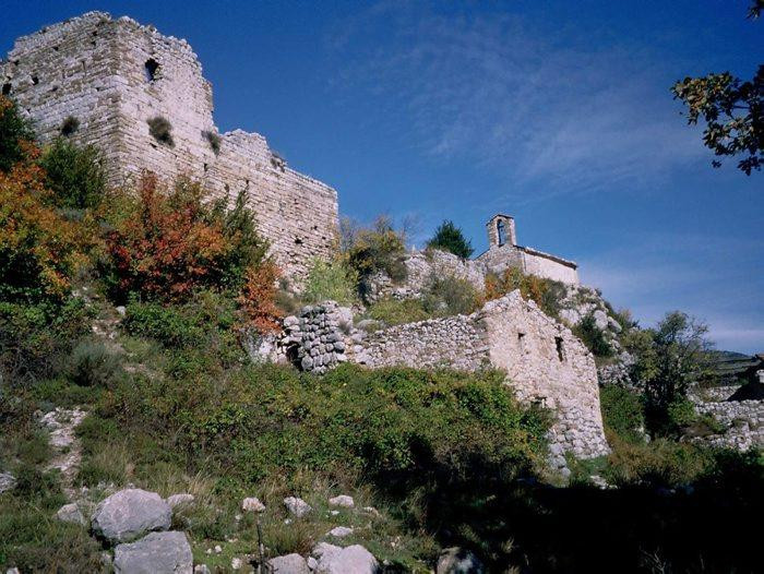
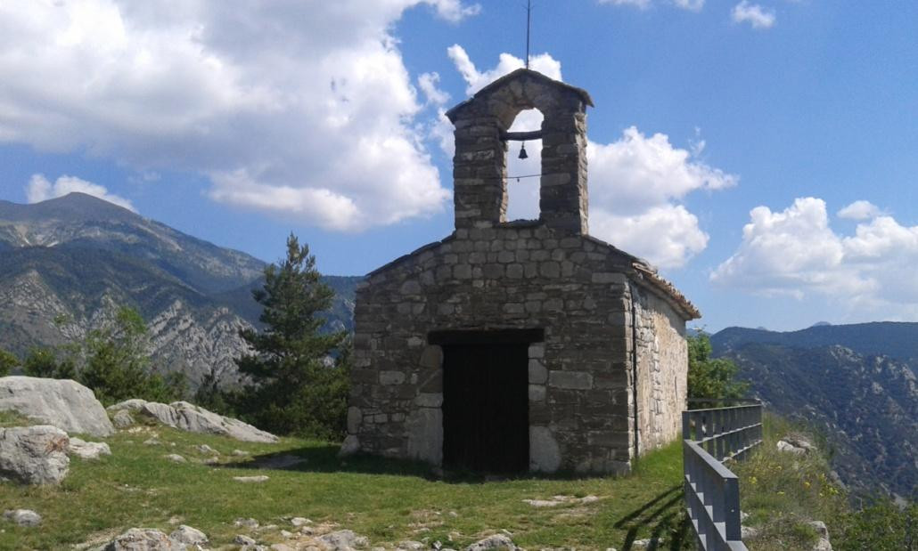
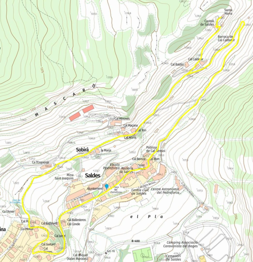
To reach the Castell de Saldes, we will leave from the Plaça Pedraforca, in front of l’Ajuntament, heading in the opposite direction from l’Església, towards the southwest, above the Pàrquing and following the signs for the “RUTA DEL CASTELL”.
These allow us to scan the QR codes and download the app, which, at various points along the route, will offer a series of riddles that will make the walk more enjoyable for the whole family.
We follow the main street until we turn right, passing by the Font de Cardina. After leaving Ca l’Esquerrà behind, we continue downhill along a concrete track towards the Barri Sobirà, passing above the La Marja house and continuing as far as cal Norra. Shortly after cal Ton, we take the path to the left, passing higher up alongside Cal Calderer, which we leave on our right as we follow a small path right next to the wall of the house. After a few metres, the Castell and the ermita de Sta. Maria will appear in front of us. We continue along the path until we reach the area directly below the Castell. The fortified building, the ermita and the remains of the wall are particularly noteworthy.
Taking a path to the left, we will arrive in front of the Castell’s still-preserved doorway and then reach the ermita.
The panoramic views are impressive: the valley of the Saldes River with the shaded area, from Maçaners to the Riera Salada, Molers, the Cadí, the Pedraforca and the Serra d’Ensija.
From here, we could take the path that continues if we wanted to reach Gresolet via the path of La Costa.
We will return along the same route until leaving the path and taking the track to the left. We then take another path to the right, which will lead us back towards the village centre. Here, we continue straight along the carrer St. Martí, then pass through the plaça and by l’Església, before arriving back at the plaça Pedraforca.
Difficulty: Easy
Duration: 1 hour
- Plaça Pedraforca, Saldes
- Font de Cardina (10 min)
- Cal Ton (25 min)
- Castell (40 min)
- Saldes (60 min)
HISTORY OF THE CASTELL
The first records of the place of Saldes date back to the year 839, when it appears under the name Sallices in the act of consecration of the Seu d’Urgell. However, the first written references to the Castell date from between 1068 and 1095, when a man named Galceran paid homage to Count Guillem Ramon de Cerdanya, Count of Berguedà. In 1118, the County of Cerdanya was incorporated into the County of Barcelona together with all its possessions, and Galceran II de Pinós swore allegiance to Ramon Berenguer III, Count of Barcelona, who held the Castell as a fief.
Between 1306 and 1316, the troops of Jaume II occupied the Castell in the context of the war between him and Pere I Galceran de Pinós.
In 1370, restoration work was carried out on the Castell, mainly on the part used as the lord’s residence.
In the 15th century, historical references to the Castell come to an end. It lost importance and began to decline, coinciding with a period marked by the guerra dels Remences and the Catalan Civil War.
In the 17th century, Saldes appears as a possession of the duc d’Alba, within the sotsvegueria de Berga and the vegueria de Manresa.
Technical sheet
Town: Saldes
Type: Easy
Zone: Saldes
Starting point: Plaça Pedraforca
Ending point: Plaça Pedraforca
Distance: 2.8 km
height difference: 90 m de desnivel +
Documents and links
OFICINA DE TURISME DEL BERGUEDÀ
Customer service opening hours:
from Monday to Friday from 9 am to 2 pm.
on public holidays falling from Monday to Friday from 10 am to 2 pm.
Tel. +34 654 125 696
E-mail: turisme@elbergueda.cat

ACKNOWLEDGMENTS


[Premsa]
Other






Follow us


